Upper Dove, from above!

Spring's
Professional Mountaineer magazine arrived and I was highly delighted when I got to page 28 to see an article by
Paul Gannon on superimposed drainage in the Peak District. Why delighted? As a volunteer leader for Staffordshire Moorlands District Council some 8 months ago I'd arranged a walk from the County's highest village, Flash, through the landscape that Paul was describing in his commentary.
I popped a couple of messages onto the Mountain Training and Staffordshire Moorland Walks facebook pages for a bit more promotion of the walk which created little pre-walk interest. I must learn to use social media in a more productive way.
Back to the walk, Paul's piece directed me towards his Rock Trails Peak District, further investigation revealing Walk 4 in his book was similar to the one I'd mapped out. Armed with all this information I was well prepared for the walk on 20 March 2016.
The weather on the day of the walk was far better than forecast and 27 turned up for the walk. I started by explaining the route, the underlying geology and the features we were likely to be seeing. Not being a geologist I used layers of a cake as an analogy to explain what we were standing on. I've used it on other walks - people seem to remember it! I'd like to make reference to beer but I've not quite worked out how to weave that in. Heading south-west out of the village there were some great views across to the gritstone of the Roaches and Ramshaw Rocks. Crossing the A53 we stopped to look at the course of the River Manifold and the explanation of the superimposed drainage leading to the river cutting through the sandstone rather than following the softer shales that run parallel to the A53. Then it was up onto access land above the Longnor Sandstone of Nield Bank, taking opportunity to have an early tea break to take in the views down the valleys of the rivers Manifold and Dove and across to the limestone apron reef formations of Chrome and Parkhouse Hills. It was also an opportunity to catch up with a couple of MTA members who I recognised from other events.

Moving on we passed the field where the River Manifold rises, then Dovehead where the River Dove starts. The Dove forms the boundary between Staffordshire and Derbyshire so we had a quick breather on the first road bridge over the young river with a foot in either County and opportunity to look at the incision the Dove had made through the sandstone.
Onwards and upwards to Brand Top to have another break, this time by an old school house and church as well as a poignant War Memorial naming local men who'd given their life in the two World Wars and the nearby hamlets they were from. Whilst here there was a peregrine falcon hovering over the valley of a tributary of the Dove. Then wham, it dropped into a stoop. Spectacular, the first time I'd seen that live, rather than on TV in a wildlife documentary. I followed it's dive for as long as possible until the sharp sides of the valley hid the intended prey from my view. The group were then led above the line of the Dove valley for another mile before heading north towards the limestone of Thirkelow Rocks, the change in the underlying rock portrayed by a change in the stones used in the walls delineating the fields.
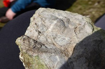
The good weather meant time for long lunch and a chance for one of our assembled walkers to point out classic solifluction and another, who identified himself as a geologist (no pressure Austin), seeking out some fossils for the group to look at.
So back towards Flash alongside Cistern's Clough and then up onto the access land at Axe Edge to the highest point of the walk for some more fantastic views down the Dove and Manifold valleys but also providing a 360 degree, including a vista across to the Cheshire peaks and beyond. The were still pockets of snow on Axe Edge and the off-piste walk allowed the group to have a closer look at the sandstone rocks. From the top of the hill half the group accompanied me to the site of an aircraft wreck, so opportunity to get the compass out and pace out along a bearing to where the remains should be. Fortunately they were and the micro nav served us well. A quick anecdote about the flight, the crew and the plane before meeting up with the rest of the group at the agreed rendezvous.
One final opportunity to use access land gave the group the opportunity visit Staffordshire's historic county top of Oliver Hill for some final fantastic views before meandering back to the start point for farewells and for me to reflect on one of those truly joyous days out in the hills.
Austin Knott is an aspirant Hill and Moorland Leader and Trainee Member of the Mountain Training Association.He helps pull together Staffordshire Moorlands District Council's walks and can be found leading walks and tramping around the South West Peak District.
